This booklet, which I originally published in 1997, was written above all for families and primary school children. It is a brief history of Hutton Rudby told through its buildings and the reminiscences of older villagers. It can also be used as a guide for anyone walking around the village - the original map drawn by Michael Brabin for the centre pages of the booklet appears at the end of this post.
I was very lucky to have been able to spend time talking with people who knew the village before the Second World War and I am glad I was able to record their memories for future generations. So much of the world they knew has now disappeared, even to the extent that people now living in the village are under the impression that it is prohibited to walk on the village Green! How surprised the former villagers, who for centuries played, grazed their livestock and wore well-established paths across the Green, would be to hear of that ...
I was very lucky to have been able to spend time talking with people who knew the village before the Second World War and I am glad I was able to record their memories for future generations. So much of the world they knew has now disappeared, even to the extent that people now living in the village are under the impression that it is prohibited to walk on the village Green! How surprised the former villagers, who for centuries played, grazed their livestock and wore well-established paths across the Green, would be to hear of that ...
I revised the text in 2005 shortly before moving to Darlington. Hutton Rudby History Society now produces the booklet, which is still on sale in the village.
The illustrations were made by Penny Pinkney in 1997.
A History Walk round Hutton Rudby
An Introduction to the Walk
Hutton Rudby was once known as Hutton-juxta-Rudby, or Hutton-nigh-Rudby, because it is really two villages: Hutton and Rudby, separated from each other by the River Leven.
How old is the village?
There have been people living here for thousands of years. Stone Age tools have been found in North End. The people of the Bronze Age buried their dead on Folly Hill in a 'round barrow', excavated in 1889 by Canon Atkinson, the famous vicar of Danby. Bronze Age arrowheads have been found and the quernstones with which people ground their corn. There were Iron Age villages near Sexhow and Hundale.
From the 1st century AD the Romans invaded and colonised Britain, and they lived here too. There are the remains of a hypocaust (the heating system for a house) by the river between Hutton Rudby and Stokesley.
Next to come were the Anglo-Saxons, warriors who came across the North Sea to Britain from the 5th century. In areas under their control most villages took Anglo-Saxon names – this village became "Hutton". After a time Christianity, which had come to Britain in Roman times, grew strong again and a church was built in Hutton, but we do not know where.
From the end of the 8th century the Vikings began raiding the coast and at last took control of the north-east of England. Hutton now lay in the Viking Kingdom of York, and the villages of Rudby, Skutterskelfe and Sexhow have Viking names.
When William the Conqueror invaded England in 1066 he divided the land amongst the men who followed him from Normandy. But in the North fighting against William continued and in 1069 William ordered his soldiers to lay waste the land, murdering the people, burning their homes and crops and killing their animals. There was nothing left to feed the people who survived, and they sold themselves into slavery or fled south to find food. The following year it was written that there was still "no village inhabited between York and Durham; they became lurking places to wild beasts and robbers and were a great dread to travellers." As a result of this, the Domesday Book in 1086 shows Hutton and Rudby to be "waste" – hardly inhabited or farmed.
The new Norman lords, the Meynills, built a church by the river, and each of the mediaeval townships, Hutton, Rudby, Skutterskelfe and Sexhow, had its own manor house. Hutton began to take the shape we know today with houses gathered around a village green, which was probably where animals were kept safe at night.
What do the place names mean?
Hutton (the –ton ending shows this is an Anglo-Saxon name) means "village on a hill".
Rudby (the –by ending shows this is a Viking name) means either "Rudi's village" (a man's name) or "Rudda's village" (a woman's name).
Sexhow means either "Sekk's hill" or "the six hills".
Skutterskelfe means "village on the bank of a stream".
Leven is a Celtic word, from the people who lived here before the Romans. It probably means "smooth".
How did the people make their living?
For hundreds of years the villagers worked in farming or at the trades which were essential for village life – as blacksmiths, millers, carpenters etc. By the 18th century Cleveland was becoming famous for its wheat, butter, cheese, cattle and horses. The villagers of Hutton Rudby had always made cloth for their own use, but from about 1700 many worked in their own homes spinning and weaving flax into linen to sell. Some flax was grown locally, but most came from the Baltic into the ports of Yarm and Stockton.
Spinning was done by the warmth of the fire with the help of light from a little window near the fireplace, while weavers worked generally in a shed near their house. The cloth they made was taken by mules to markets all over the North East.
This linen industry became more and more important, until by 1831 the village had more weavers for its size than any other village in the North Riding of Yorkshire.
The coming and going of the weavers themselves, the bales of flax and the webs of finished cloth, made the village an active and outward-looking place. In the heyday of smuggling between 1750 and 1830, when vast amounts of tea, coffee, gin, tobacco, wines and soap were being brought ashore by the smuggling gangs on the Cleveland coast, people in Hutton Rudby were engaged in the secret trade of getting the smuggled goods into the towns and villages of the countryside. In those days, people of neighbouring townships claimed that the village was so notorious for its smugglers and thieves that no one would give Hutton Rudby women work as servants, and they were fond of quoting the rhyme:
Hutton Rudby and Enterpen
Far more rogues than honest men
In 1834 a power-driven spinning mill was established alongside the Hutton corn mill, beside the bridge over the Leven. From then on this was the centre of the village weaving, and for over 70 years sailcloth was made here, first by water- and then by steam-power.
What was life in the village like in the past?
A hundred and fifty years ago, when the mill was working, the village was obviously much smaller than it is now, but there would have been many more people around in the day because they did not need to leave the village to go to work or to shop. Weavers, cobblers, cartwrights, tailors, shopkeepers etc all worked in the village, which was a busy and lively place, noisy with the clatter of the weavers' looms. Bricks were made on Campion Lane, there was a sawmill in Enterpen, and there were even miners who lived in the village and walked to work in Swainby over the fields.
We begin our walk at the War Memorial
Hutton has two village Greens. From the War Memorial we can see only a little of the large Green, which slopes out of sight down to East Side, but we have a good view of the smaller Green of North End, stretching away from us downhill. North End may be the oldest part of Hutton – the main Green was probably a planned later addition to the village.
Hutton has two village Greens. From the War Memorial we can see only a little of the large Green, which slopes out of sight down to East Side, but we have a good view of the smaller Green of North End, stretching away from us downhill. North End may be the oldest part of Hutton – the main Green was probably a planned later addition to the village.
Follow the road down North End
North End
On the left is Elwick Terrace. These red-brick houses were built next to a much older cottage in 1905 by John George Garbutt, who also built Elwick House in West End.
Nearby can still be seen part of the cobbled path which ran in front of the houses around the Greens, and which is now mostly covered by modern pavement. When geese grazed on the Green, before the Second World War, they would gather on the cobbles leaving quite a mess – it was the children's job to chase them off!
Follow the road downhill beyond Greenbank Terrace
Greenbank Terrace was known until 1915 as Tisbut Row. In 1839 there were four dwelling houses here, together with three workshops and a stable. The terraces just above Tisbut Row contained four cottages, four workshops, a coalhouse, a warehouse, a counting-house, a stable and a gig-house.
In the cottages around North End Green lived many of the village's weavers. Weaving villages were quick to follow the teachings of John Wesley (1703-91) the founder of Methodism. He visited Hutton Rudby a dozen times between 1759 and 1790, writing in his diary in 1766 that the Methodist society here was "the largest in these parts and the most alive to God".
The house furthest down the hill in the terrace that forms an island in the middle of the North End Green was the original Wesleyan Methodist Chapel. It was built in 1759 to hold 200 people, but was not big enough for the crowds that came to hear Wesley speak, and he had to preach to them outside on the Green.
The old Chapel and its Sunday School were used for worship for 120 years. For a while the building was a Temperance Hall; it is now a house. The other houses in the terrace were built on later.
Next door to the old Chapel was The Bungalow, which was used as "refreshment rooms" and a dance hall before the Village Hall was built, and was afterwards a cycle shop. It was then replaced by the present house.
Walk around North End
Here you will find good examples of the weavers' cottages, often altered or rebuilt, but showing many interesting old features.
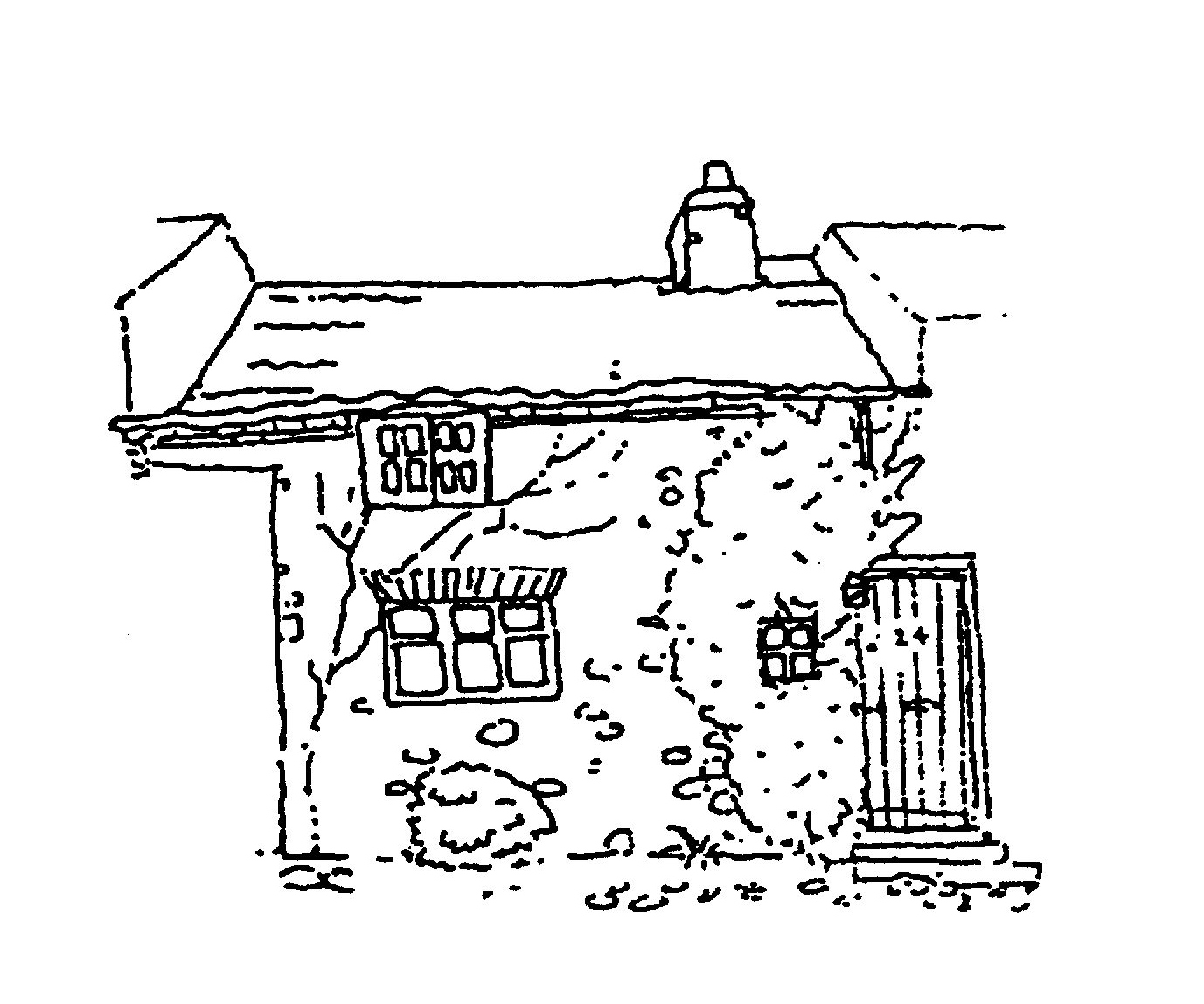
Number 24, for example, has a Spinner's Window, which gave light to the spinning wheel by the fireside. The upstairs window is a Yorkshire Sliding Light, common in cottages with low ceilings upstairs. It is opened by sliding the pane to the side. There is also a Flying Freehold. This is the name given to the ownership of an upstairs room which is directly above part of the ground floor belonging to the house next door.
Number 24, for example, has a Spinner's Window, which gave light to the spinning wheel by the fireside. The upstairs window is a Yorkshire Sliding Light, common in cottages with low ceilings upstairs. It is opened by sliding the pane to the side. There is also a Flying Freehold. This is the name given to the ownership of an upstairs room which is directly above part of the ground floor belonging to the house next door.
Long ago houses in Hutton would have been built of wood, but from the "great rebuilding" of the 17th century houses all over England began to be rebuilt in stone or brick. Here, with nowhere nearby to quarry good building stone, river cobbles were used, often in walls of double thickness with a layer of rubble between. Many of the houses around the Greens were built in this way, but the cobble walls are now hidden behind rendering. At Yarm in about 1650 they began to build in brick, and as time went on brick was used instead of cobble across the whole area. You may notice houses in Hutton which began as single-storey cobble-built cottages, and were later made into two-storey houses by building onto the cobble walls with brick, and so raising the roof level. Bricks were always made near to the building site, and their colour varies according to when and where they were made.
Until the early 19th century most roofs were thatched with straw or heather. The red S-shaped pantiles we see today were imported from Holland into Yarm from the late 17th century, but they took a long time to replace thatch throughout the area – particularly as they did not keep the house so warm! On some of the older houses in the village – Number 33 North End, for example – you may see a high stone edging to the side of the roof. This high gable end was needed to hold the edge of the thatch.
Some roofs here are made of slate. This only became possible when the railway came, because slate comes from outside this district.
People living in North End could fetch their water from two wells on their Green, or from another behind Tisbut Row. They could walk to work at the mill by following either of the paths that lead across Honeymans Field and down Crow Bank to the river – now favourite local walks.
At the far end of North End, overlooking the river, is Mill Hill House which has long belonged to descendants of the Bewick family, linen manufacturers throughout the 19th century. Beyond North End lay Codlins Wood and Mill Hill.
Walk back up North End, following the path from Pear Tree Cottage
The terraced houses on the left were built in the first part of the 20th century and were the last to use the bricks made from the clay pits at Burnt House Farm. The field in which they were built was known until 1914 as the Onion Garth or the Mustard Garth, and was used for allotments. The idea of working people growing their own vegetables on allotments began in about 1780, as a solution to the problem of poverty in the countryside. In the 19th century the village people did not have holidays, and their spare time at the end of the day would be spent working on their gardens or allotments.
Longshort Graphics is in a building which was, by the late 19th century, a Mechanics Institute. These were established to give working people the opportunity to learn and study. It was later used as a Reading Room and Library, then a Snooker Hall, and in the 1960s was a shop. Originally it was a long, low building but it was altered in about 1900 when it was given a mock-Tudor black-and-white frontage.
North Side
The house at the corner has been the home of the Post Office since the middle of the 19th century. From about 1880 the Hall family had the business, which was also a grocer's, tailor's and draper's shop. Miss May Hall was long remembered in the village. She ran the telephone exchange in the days before direct dialling, and slept downstairs on a sofa so as to be at hand night and day. In the 1930s fresh local produce was sold here, and Mrs Flintoff of Doddle Hill Farm would drive into the village in her pony and trap bringing butter and eggs to be sold.
Photographs show tin advertisements fixed to the wall overlooking North End. A favourite game of the village boys at the time of the First World War was bouncing tennis balls against the advertisement for Colman's Mustard, because of the satisfyingly loud noise this made!
Walk down North Side towards the King's Head
The Green was once known as High Street; the names North and South Side began to be used at the end of the 19th century.
In the early 19th century the public house at this end of North Side was called the Shoulder of Mutton, somewhere to the east of the present King's Head. This terrace of houses was re-organised and partially rebuilt in the middle of the century and the King's Head is first listed in White's Directory of 1840 – its landlord was Jeremiah Raney, whose family had the Wheatsheaf for many years afterwards. In a yard behind the pub at this time were several cottages occupied by weavers, labourers, a coal dealer and a brickmaker.
When work was done on the cottage next door to the King's Head in the 1970s a large quantity of animal teeth were found, suggesting that this had once been a butcher's. There were a great many butchers and slaughterers working in the village from the late 19th century until the Second World War. Some worked from shops on the Green, others were "slinkbutchers" who used to kill animals dying from disease. One of these worked from a tin hut on the land where Rudby Lea now stands.
Before the Second World War, the butchers' refuse was dumped in the Blood Midden – the ponds off Green Lane to the west of Campion Lane. The smell was dreadful, especially when the farmer spread the rotted waste as muck, but it was a very popular place to go ratting, as the rats there grew "as big as terriers".
It has been said that the house dated 1745 with the mounting block (the last left on public view in the village) was once a pub, possibly called the William IV – it certainly used to have a fine sandstone cellar.

For many years from the middle of the 19th century it was the home of the Bainbridge family, carriers for at least five generations. The carrier was important in village life, because he would fetch from the market towns and deliver to the door the goods that people could not buy in the village. Willy Bainbridge (1890-1949) took his pony and cart twice a week to Stockton market, which was in those days the most important in the area. In the winter he would keep his horse and cow on the land behind this cottage, driving them in through the front door. The door, like many others in the village, opens into a passageway that leads straight through to the back. The house had no well, but the Bainbridge children could fetch water from the pump in North End or the well in front of Church House.
Next door but one is a house that for many years was a shop, as can be seen from old photographs. Until recent times it was a hairdresser's salon.
At the end of the terrace is the one-storey building that for many years has housed the Honeyman family butcher's shop. Joseph and James Honeyman were butchers in the village from about 1880, and in 1914 Percy C. Honeyman was paying rates on a shop and buildings on North Side. The house next door to the shop was built in about 1900.
There used to be very many more shops around the village – on the Green before 1914 there were tailors, a watchmaker, a plumber, a blacksmith, a wheelwright and various grocers' shops.
The Methodist Church was built at a cost of £838 in 1879 by the Wesleyan Methodists to replace the old chapel, which was by then "in a worn-out condition". Sunday School was always an important part of Methodism, and the new chapel was built with a schoolroom designed to hold 100 pupils. It is in a simplified Gothic style, with pointed arches over the doors and windows. There used to be railings around the wall in front of the church, but these must have been taken to be melted down for munitions in the War. In 1992 the porch was enlarged, and in 2005 work began on building upper rooms for the church's youth work.
For most of the village's history, there were no trees on the Green. In 1878 three young men of the village, perhaps inspired by the lime trees planted on Stokesley Green a few years earlier, called a public meeting where it was decided to hold a fundraising concert and ask for donations to plant an 'Avenue' – lines of trees down North End and along the Green. Many were planted by children and young men and women – the conker tree opposite Dick's Fish Shop, for example, was planted by the village boys and Mr Joseph Mease of Leven Valley (1827-1928).
Wellwood House, beside the Chapel, was built in the 1880s. Before the Second World War, the Misses Sidgwick ran a private school in the house. The houses down North Side often had their own wells, and several of the house names – Wellwood, Springwell, Wellbeck, etc – reflect this.
The house next door was once known as Jubilee Cottages, presumably because it was built or rebuilt in Queen Victoria's Jubilee Year, 1887.
The area around the small terrace of cottages and the large house called Crowbank was known until 1920 as Castlegarth – it is not known why. Perhaps traces of stone buildings on the site inspired the name – it is interesting to speculate that these may even have been the remains of the original church.

Crowbank was for many years a shop. During the Second World War soldiers were billetted here, and the garden was turned over to the schoolchildren to "Dig for Victory".
They had to lift the turf and use compost to grow vegetables – a surprise for the farm children, as they expected to plough the grass in and use muck.
Crow Well Lane, the public footpath to the side of Crowell House, joins the path that runs from Honeymans Field and continues down Crow Bank to the old mill site. Near where the paths meet was Crow Well, and also one of the village rubbish dumps. At the back of the houses here was a "pill box", a Second World War gun emplacement, and nearby was a pit into which George Stringer's shire horse once fell and had to be winched out.
Miss Foggin the schoolmistress lived next to the lane for many years, in the house now rebuilt as Eva's Cottage.
Three doors down, established in 1903 and in business for over 30 years, was MacCutcheons the watchmaker and cycle repairer – children could buy elastic for their catapults here.
The double-fronted house, Number 14, is still remembered as the home of Stanley Snowdon, son of Dr Snowdon. The house, which was later enlarged by extending it into the cottage next door, was in the late 19th century the home of Henry Passman, who was towards the end of his life the Lord of the Manor of Hutton. His family had acquired the land with which the lordship passed in the early years of the century. After mediaeval times the lands of Hutton were divided up between several landowners, and there was no powerful Lord of the Manor living the village. This gave the people of Hutton more freedom and independence in the way they ran their lives than people in many other villages.
The house next door was Jacksons', butchers before the First World War.
During the Second World War the school pigs were kept behind the houses at this end of North Side. Fed by the schoolchildren on scraps, they grew to be very hairy indeed.
Stringer's Row, the next terrace, was once known as Miss Paver's Cottages. A comparison with the old photographs will show the sympathetic extension to the terrace carried out in the 1990s.

Miss Paver lived from the 1870s in the fine stone and slate house, The Elms, which may take its name from the elm tree she planted nearby in 1879 when the avenue of trees was created. Later it was the home of Mr Knowles, the village schoolmaster, his wife and daughter. The frontage of the house was altered in the 19th century, when the slate roof was put on at the front, but it may have originally been built from the remains of the old Rudby Manor House, which stood in the field opposite the church until the early 18th century. Stone from the manor house was still being used by local farmers in the 19th century.
Old maps and photographs show that there were several more paths and tracks across the Green in the 19th century, and the line of a path probably used as a turning circle for horse-drawn vehicles can still be seen in the grass in front of The Elms.
Until the 1950s the Bay Horse was smaller, consisting of the little row of cottages overlooking Hutton Bank. For many years there was a large shop in what is now the carpark, and attached to this was the original Greaves' Garage. When Horace Greaves came back from the First World War he started up a cycle shop, but seeing the opportunities just beginning he applied for one of the first Morris dealerships in the country. The building was later transferred to Garbutts Lane, to buildings which had been used by the Blue Riband bus company, established by Alban Frederick Smith and his partner Jack Fortune. This was the first bus sevice to run between the village and Stockton on market days, and it began operations in 1922.
In the 19th century a cluster of shops, cottages and workshops stood around the yard beside the Bay Horse. There were several similar yards in the village, their names changing over time according to the inhabitants and the landlord. At one point the Bay Horse yard was known as Jacksons Yard. It was here in 1832 that the cholera outbreak began.
The first world-wide outbreak of Asiatic Cholera – also called Spasmodic Cholera from the agonising spasms it caused – had begun in India in 1817. It spread steadily along the trade-routes, arriving in Moscow in August 1830 and reaching Sunderland in August 1831. Nobody knew what caused this mysterious and frightening disease that killed half its victims. It was not until 1855, after the third cholera pandemic, that Dr John Snow was able to demonstrate that cholera was linked to contaminated drinking water, and the bacillus that causes the disease was not identified by Koch until 1883. We know, as the villagers of 1832 did not, that cholera occurs when the bacillus, carried in faeces, contaminates food or water supplies. We know that the dungheaps, overflowing cesspits and seeping privies which were thought at the time to be just "nuisances", were in fact a serious danger to the water supply and to the villagers' health.
Cholera had been rife in the North East for a year and had only recently reached Stockton, when a Hutton linen weaver named John Cook returned to the village from Newcastle. He had not been well before he left home, probably with some sort of summer stomach upset, but his health must have caused alarm in Newcastle and he was taken to the cholera hospital. He was discharged from the hospital on Monday 1st October 1832 – but by then he had in fact caught the disease. He reached his house in the Bay Horse Yard at about 9 o'clock in the evening the next day and died within hours. He was swiftly buried on the Wednesday, but by Thursday it was clear that cholera had broken out in the houses around the yard and along East Side. The water in the well in the yard had been contaminated – probably with the dirty water thrown out when the women had washed Cook's body, his clothes and his bedlinen.
The outbreak was swift and explosive – in all there were 45 cases, and 23 people died in the space of a few weeks. Neighbouring towns and villages tried to keep out travellers from Hutton Rudby, but it is said that two-thirds of the villagers left very quickly for friends and relatives in the surrounding countryside, and the village was so quiet that rabbits and hares fed unharmed on the Green.
Doctors came from all around the area to help and to learn all they could about the new disease, and the Revd Robert Joseph Barlow, who had just come to the village as vicar, was energetic in his practical help and support of his parishioners. He swiftly took charge, organising the burning of the victims' clothes, the fumigation of their houses and the rapid burial of the bodies in a common grave, as the government required. He raised donations from the local landowners and he himself provided food and clothing for the afflicted families, tirelessly visiting the sick and the dying. Within three weeks the outbreak was almost over, but the villagers did not forget Mr Barlow's work in the time of the cholera. Village tradition has it that the vicar himself lent a hand in digging the mass grave which is still to be seen near the north wall of the church.
Go down the hill towards the river
Hutton Bank and the River Leven
At the beginning of the 20th century the river was much deeper than it is today. Children would swim in the river at Sexhow, and herons and otters were common. In the very cold weather of December 1896, young Bob Dodsworth and Tom Milburn skated down the river from Hutton Mill to Crathorne Mill. Trouble was waiting for them when they got home, because they had screwed the skate blades into their good boots!
Four hundred years ago, the bridge across the river was made of wood and stood a little to the east of the stone bridge we see today. This was built in 1755 at a cost of £150. It was a narrow bridge, and in 1972 was widened to the full width of the road. On the right, steep steps drop down to the footpath known as the Botts. This used to run across the middle of the flat land at the bottom of the hill but was diverted alongside the river bank when the houses of Levenside were built. It leads to Sexhow Lane.
On the left is the field in which Hutton Mill stood. The village corn mill stood here for centuries – rates were still being paid on it in 1919 – but from about 1757 until 1830 paper was also made here, using rags left as waste from the linen trade. Then the Mease family of Stokesley bought the site for conversion to a power-driven flax mill. In 1857 George Wilson began to run the mill, making sailcloth for the Navy. His success meant that while the linen industry was dying out in neighbouring towns and villages, Hutton Mill and the bleach works down by the river (now a house called The Holmes) continued to provide work here. George Wilson and his sons, Allan and Thomas Bowes Wilson, ran the Mill until it finally closed in 1908.
The mill wheel was worked by water from the mill race. This was a man-made stream that cut the bend of the river, and ran from south-east of the bridge across the area on which Levenside now stands, flowing under the road and on into the mill. It rejoined the river to the west of the bridge. The road was carried over the race by a brick archway. There are remains of machinery, possibly from the sluice, by the river bank along Levenside.
Near the race stood the old mill house. According to Mr Eddowes, the vicar between 1916 and 1927, this was the home of a woman who fell very ill and was given up for dead. She was buried wearing a fine ring, which the sexton decided to steal. He uncovered the coffin and tried to remove the ring from the woman's hand. Finding this impossible, he began to cut off her finger with his pocket-knife. To his unspeakable horror, the woman awoke screaming! She made her way home to her amazed and delighted husband. He rewarded the sexton for the attempted theft that had woken his wife from coma with a gift of linen every year. Villagers used to tell children that the old statue of a figure with one hand raised (on the north side of the church and now much damaged) was the lady holding up her injured finger!
John Mease replaced the old mill house in the mid-19th century with Leven House, the tall house standing at the entrance to Levenside. In its heyday Leven House had stables and coachhouses at the top of Hutton Bank, and large gardens that were probably created after the Mill was converted to steam power in the 1870s and the race was no longer needed. The gardens were sold in 1969, and the Levenside estate was built there.
When the Mill was converted to steam power the Wilsons employed skilled workers from Scotland to work the new machinery. Many of these were young women, and some local lads went to watch their arrival at Potto Station, where they picked out the girls they would marry!
It is hard now to imagine that for many years there was at the bottom of Hutton Bank a large Mill with a tall chimney and warehouses. There were cottages standing close to the road, where for a time the village policeman lived. The Mill worked from 6 a.m. to 6 p.m. and the workers coming out at the end of their shift would be covered with white fluff.
After the Mill closed, the buildings were used by a rifle club, as a practice room for the village band, and for meetings and dances, but finally the Mill and cottages were demolished in the 1930s so that the dangerously narrow road could be widened. All that remains of the cottage gardens are the hawthorn bushes growing up the the bank.
Rudby
Over the river lies Rudby. The road from Hutton continues up Rudby Bank to Stokesley. In the past when many people kept a few cows to supply themselves with milk and sell any extra, they would take them out to graze from late April or early May. People who did not have enough grazing of their own would lead their cows along the grass verges of the road. This was known as tenting, and was possible because there was little traffic before the Second World War, the roads were narrower and the verges wider. But Rudby Bank would then be slippery with the cowpats – and the cyclists used to complain!
The mediaeval village of Rudby, with its own Green, disappeared long ago. It lay to the west of the present Rudby Farm. It had its own corn mill by the river, now a house called Leven Valley, and a Manor House that stood until the early 18th century in Hall Garth, the field opposite the Church.
In the 19th century between 80 and 90 people lived in Rudby; in 1937 the figure had dropped to 53. After the Second War there were only eight houses here, and the daughter of Mr Craven, the gamekeeper at Skutterskelfe Hall, ran a little shop in which you could buy sweets, lemonade, toys and birthday cards.
For most of the 18th and 19th centuries the manors of Rudby and Skutterskelfe were owned by the Falkland family, whose tombs and memorials can be seen in the Church and the graveyard. They lived in Skutterskelfe Hall (now "Rudby Hall") which was built in 1831 by the 10th Viscount Falkland and his wife, who was a daughter of King William IV and the much-loved actress Dorothy Jordan. At the end of the 19th century the family sold their lands here to Sir Robert Ropner, who had made his fortune in shipping. It was good for Rudby when there was a family living at the Hall, because this provided work for servants, gamekeepers etc.
Next to the churchyard wall stands a small cottage, to which dormer windows have recently been added. It was built in 1740 by Charles Bathurst of Skutterskelfe for a school-house, paid for by a charge on the Skutterskelfe estate. This was the Bathurst Charity School, open to boys and girls.

All Saints' Church stands on the Rudby side of the river, which is why the parish is called Rudby-in-Cleveland. Its position in a river valley rather than on a hill top is unusual. Some have suggested that it was built here by the Meynell family in the middle of the 12th century to be shared by the villages of Rudby and Hutton, while others have compared the site to those favoured for monasteries. Some think that the mysterious moated area in the churchyard could have been part of the monks' fishponds.
In the time after the Reformation, when Henry VIII declared himself head of the Church in England and closed the monasteries, everyone was made by law to go to the new services in the parish church or pay a fine. In spite of this, many people in Cleveland stayed loyal to their old Catholic faith, worshipping in secret, and Hutton Rudby was for a while one of the largest Catholic centres in Cleveland. As time went by, the new Protestant form of worship grew more popular, especially during the Civil War, and from the 18th century Wesleyan Methodism became very popular with the many weavers in the village.
Behind the Church and the original churchyard is the parish burial ground, and to the right is Church Holme, a small field until recently considered too low-lying to be suitable for use as a graveyard. It was part of a larger piece of land known once as the Butts, and this name, which means the targets used for archery practice, shows that this is probably where the mediaeval villagers practised with the longbow. In the days when the skill of the English bowmen won the battles of Crecy and Agincourt, boys were taught to draw a bow from a young age, football and handball were against the law (because they distracted men from practising archery), and on Sundays and Holy Days archery practice was compulsory. The bows were about five feet long, and the arrows – about three feet long, with sharp tips of steel – could go through an oak door four inches thick. If someone was killed by an archer while practising, it counted as an accident, and not a crime.
Beyond lies Church Wood, with the remains of John Miller's Well, and behind it is Folly Hill. In the Baines' Directory of 1823 this is described as "a conspicuous seamark, which may be seen at the distance of twenty leagues upon the German Ocean" (the North Sea). Later it became noted for the Bronze Age burial mound excavated by Canon Atkinson of Danby.
Opposite the Church, in the area now used as a car park, there once stood a large brick building, used by the Ropner family carriage during church services. The Parish Bier was kept here for funerals. It had been bought by ladies and gentlemen of the village in 1899 for parish use.
Go back to the top of Hutton Bank
At this end of East Side, opposite the Bay Horse, are the buildings which were once the stables for Leven House. Here you can see a weather vane in the shape of a fox, which looks very like the one that used to stand on top of the maypole, which had been put up on the Green in 1887 to mark Queen Victoria's Jubilee. The schoolmaster before the First World War used to ask the children if they had noticed which way the wind was blowing on the way to school – but they never had!
East Side
In the mid-18th century, the middle of East Side was taken up by a traditional North Yorkshire longhouse, where the "low end" was occupied by animals. It had a parlour, chambers, garrets, a stable with a manger, a horse stone and a stone trough. It was possibly the successor to the manor house used centuries earlier by the steward for the lord of the manor, and it had perhaps become the forerunner of the Wheatsheaf Inn. This pub was certainly in existence at the beginning of the 19th century, though perhaps in a slightly different position – by the middle of the century it was called the Old Wheatsheaf Inn. The longhouse was split up during the second part of the 18th century into separate houses.
The northern end of East Side was rebuilt in the early 19th century, while the area around the Wheatsheaf was redeveloped in the middle of the century. Opposite the Bay Horse is the passage leading to Bake House Yard, a name still in use in 1920. The area just to the north of the Wheatsheaf was known in the 1840s as "Little London", while the hill down to the river behind the pub was called Bensons Bank after the Revd Isaac Benson of Acklam, who owned property here in the middle of the century. Further along is the Wheatsheaf Yard where, before the First World War, Mr Charlton the wheelwright and Mr Cook the blacksmith worked. After the Second War, Fred (or some say, Ted) Smith, known as "Cowboy", rented the cottage and used to cut people's hair in a henhouse in the Yard. In the corner beyond the doctors' surgery was Kays Yard, after the family who owned the houses there for much of the 19th century.
The cobbles edging the Green can still be seen along East Side. Most of the cobbles disappeared under the pavements that were laid after the Second War, when the laying of the water and electric mains had left the cobbles very uneven.

At the end of the Row is Hutton House. The original Hutton House had stables, a coach-house and out-offices with land attached. It was owned by the Rudby and Skutterskelfe estate and seems to have been the home of the Revd Richard Shepherd and his family before his untimely death in 1830. In 1841 it was rented by Thomas Harker, the village surgeon. George Wilson the mill-owner was living here by 1851 and using some of the buildings for his business, probably for storing sailcloth. As the Mill prospered, his family became important figures in the village. They were employers and landlords, increasingly active in public life. In the 1890s Allan Bowes Wilson seems to have bought the lordship of the manor of Hutton. In the early 1880s, after his father's death, he rebuilt and altered the house, adding the distinctive tower, reminiscent of a Border pele tower. At the same time George Young Blair, who had made a large fortune building ships' engines at Stockton, built Drumrauch Hall, with its tower in the Scottish-Baronial style. Towers were very much in fashion at the time locally.
Members of the Bowes Wilson family lived in Hutton House until after the Second World War, and influenced life on the Green a great deal. From the house we can see the gable end of the cottage beside the Spar shop, part of which was long ago painted black. Under the black paint lies an advertisement for Robsons, Painters & Decorators, who worked from a house nearby. Mr Bowes Wilson objected to seeing this advert from his windows, and it was painted over. In recent years the rain has washed much of the paint away, and sometimes the original advertisement has been dimly made out.
During the Second World War part of Hutton House was used as an Officers' Mess. It was divided into two houses after the War.
Follow the road down the Wynd and into Enterpen
The Wynd
The Wynd is sometimes spelt Weend on old maps. It is a mediaeval name for a secondary town road, and it once ran through the common land, which everyone could use for grazing.
The buildings immediately behind South Side were built by Mr Bowes Wilson as part of his orchards and gardens. Barthrams, the Funeral Directors, is here; its premises were in North End before the Second War. Part of the Hutton House land was sold off after 1945 for Wynd House, which was built by Dr Bennett.
Between Wynd House and Pyah runs the footpath called the Wellstand which led to Cat Kill Well before joining the road to Sexhow. The well seems to have disappeared when Mr Bowes Wilson's gardens were enlarged. One of the village rubbish dumps was near here.
Pyah stands on the site of the smithy that belonged to the Wood family, who were blacksmiths in Hutton for many years. Mark Wood made the railings that were put around the saplings planted on the Green. The family lived opposite the smithy, at the corner of the Wynd. Here, in the middle of the 19th century, was another village pub. In the 1820s it was known as the Carpenters Arms, and the publican Edward Meynell had his cartwright's workshop next door. One of the few village privies stood in the garden! Later it was known as the Board, and the map of 1858 calls it the Plough & Harrow.
Enterpen
The meaning of the name Enterpen is not known; it may refer to the pinfold, the "pound" in which straying animals were kept until their owners paid to get them back. On the 1893 map the pound is shown at the top of Sexhow Lane, near the back of Sawmill House.
Before the railways there was stabling in Enterpen for up to 50 pack mules, whose job it was to carry the linen cloth made in the village to market. Linen was sent to the ports of Stockton and Whitby, to local markets such as Stokesley and Guisborough, and further afield to Thirsk, York and to the Bigg Market in Newcastle.
On the left is the Old School. This was built in 1836 by the hard work and determination of the vicar, Mr Barlow. There were several schools in the village when he arrived in 1831, but Mr Barlow (who was generously paying towards the education of a good number of the children himself) felt it could be better organised. In those days of church rivalries he wanted as many children as possible to be educated in a Church of England school, especially as the village was so heavily Methodist, and he arranged for funding from the National Society and himself drew up the plans and supervised the building work. The villagers evidently agreed with the vicar that a proper new school building was needed, and he was able to persuade Mark Barker to provide the site and local farmers, Methodist and Anglican alike, to provide materials.
By the time of Mr Barlow's death in 1878 the school was not exactly flourishing. In 1879 it was taken over by the School Board, the buildings were altered and enlarged, and it became the Rudby County School. The headmaster wrote in his Log Book on March 18th 1879,
"Opened this school at 9 o'clock, and admitted 49 children. Examined them and found them utterly ignorant, ill-behaved, disorderly, and shewing no symptoms of having at any time attended a school."By 1881 there were 150 children at the school, and an Infant Department was added in 1888, so that the school could take 170 pupils.
School life today is very different from that remembered by our oldest villagers. The school was heated by coal fires lit by the caretaker every morning. Water came from the pump in the yard, and there were outside lavatories. The children learned to cook in the Cookery Van, which visited perhaps once a year. It was a big heavy van drawn by horses, and was parked in the yard. There was a stove in it, and the children would do the washing up at the pump.
The schoolmaster sometimes took the children out of school – to see the Mill being demolished, or Caul Beck running so high that it covered the footbridge, or perhaps just to see the hunt meet. When Mr Mease of Leven Valley, who had worked in his youth in Hutton corn mill by the river, was 90 years old, the children were taken out to line the street as he went by. Some thought he was Father Christmas because of his long white beard. They were also taken out of school for classmates' funerals, and in those days before antibiotics everyone was alarmed to see the little black van from the fever hospital coming to collect a patient.
In summer the man from Eldorado Ices, who came out from Stockton on a bicycle and cart with the sign "Stop Me And Buy One", used to stop at the school gates on his way to Sheepwash. He sold blocks of icecream wrapped in paper for a penny, but if two children had a halfpenny each he would cut one in half for them to share.
Many children stayed at this school until they were fourteen years old; some went on to grammar school in Yarm. During the Second World War, so many children were sent to the village as evacuees that there was not enough space for them all. For a while half were taught in the morning and half in the afternoon – the children were disappointed when temporary classrooms were set up in the village and everyone had a full day at school again!
The school finally closed in 1975, when the new school on Doctors Lane was built.
At the top of Sexhow Lane is the garage originally built by Alban Frederick Smith, who with Jack Fortune ran the Blue Riband Bus service. The lane runs downhill past the old clay pits to cross Caul Beck – this is still known as the Watersplash, even though the beck was bridged long ago. Old photographs show the lane in the days when the water still ran across the road and a footbridge was provided for people wishing to keep their feet dry.
The lane runs on past Sexhow Hall Farm, the site of the old manor house of Sexhow. There was a mediaeval fortified house here, and the gentlemen of Cleveland who opposed King Charles I met here in the days of the Civil War.
From the lane a footpath runs through Chappie's Field to Potto. The name may come from the Chapman family who farmed at Enterpen for many years, or it may be a corruption of Cat Kill Hills, the old field name. This was still in use in 1919, when the Rate Books show that a garden on Catkill Hill was owned by Dr Snowdon and occupied by Margaret Imison.
Sawmill House is nearby. The sawmill was working in the 1880s, and the site was afterwards used by the Bainbridge family's building firm, which had been in business since 1814. In its heyday this employed 30 or 40 men, paid perhaps twopence halfpenny an hour.
Before the Second World War a Dr Walker prepared Sawmill House for use as a nursing home, but he died in a car accident just before it was due to open.
Poplar Avenue was once known as Raintub Alley, because each house kept a tub outside the door to collect the rainwater. There was a time when someone living in one of the houses kept pigeons, but they fouled the water in the tubs and so were not too popular with the neighbours. The King family ran a laundry here. In the 19th century this area was called the Brickgarth.
The first houses we come to as we enter Enterpen from the Wynd are semi-detached houses built in the 1930s. But it seems that in the past there were cottages, often built in yards, along Enterpen, which have now disappeared. Building work over the years has uncovered foundations at this end of Enterpen and behind Chestnut Cottage and Enterpen Hall.
We pass the entrance to the The Old Orchard, built on the old Tarrans Yard. The Tarrans were in business here as builders for over a hundred years. Willins Close, off Langbaurgh Road, is named after the aunt of the founder of the business, who lived here on Enterpen with her nieces in 1891. The Willins family had owned property here since the early 19th century.
Opposite, set back from the road, is Lowfield, known in 1914 as 'Kelsey Castle' – apparently a jokey reference to the previous owner of the fields, the yeoman Simon Kelsey. From this house the Sidgwick family once ran their dairy. It is well remembered in the village, and was run at different times from Lowfield, Town End and West End. In those days the milk was fresh from the cow, unpasteurised, and taken round to customers twice a day.
Rose Cottage is where Lord and Lady Falkland set up a short-lived Cottage Hospital in 1892. It had four beds, Sister Florence was in charge, and Dr Snowdon was the supervising doctor. Visitors were allowed on Saturday and Sunday afternoons, and Saturday and Wednesday evenings.
Enterpen House was once the stables for Enterpen Hall, converted into a house in the 1960s. The buildings were empty for some time before then, and an informal girls' club used to meet here for a while.
Enterpen Hall was built in the late 1870s by Thomas Bowes Wilson of the Mill. From 1920 Sir Bedford Dorman, son of Sir Arthur Dorman, ironmaster and founder of Dorman, Long & Co, lived here. His wife was an invalid, and was long remembered travelling about the village in a little phaeton drawn by a Shetland pony driven by George Stringer.
The house between the Hall and its stables was used as the chauffeur's cottage, and in it was the gun room for the Hall. It may once have been an inn, The Chequers.
Over the road is Highfield. This was built at the end of the 19th century by Henry Chapman of Enterpen Farm, and was the home for many years of Mrs Hutchinson of Toft Hill, mother of the young men who called the meeting proposing to plant trees on the Green. She lived here until her death in 1920. Henry Chapman himself then lived in Highfield after retiring from farming. Sir Bedford Dorman, who lived opposite, apparently always regretted that Highfield had been built as it blocked the view of the hills from the Hall. It has been substantially added to since then.
Chestnut Cottage seems to have been a smallholding for most of the 19th century. It has been altered and enlarged over the years, and takes its name from a large chestnut tree, now gone, which grew in the front garden. The depression in the ground where the roots were dug out can still be seen.
Layton House appears to have been built or rebuilt in the mid-19th century. In the early part of the century much of this area was owned by the Sidgwick family. The house name appears to have been taken from the family who lived at Sexhow Hall and owned the manors of Hutton, Thoraldby and Braworth in the late 16th century – the Lady Chapel in the church is also known as the Layton Chapel. In the late 1920s Dr Proctor had his surgery here. The small terrace of houses next door was built in the early 20th century.
Opposite is Enterpen Farm, home of the Chapman family for several generations from the end of the 18th century. They were tenant farmers, renting first from Sir William Foulis in the 1830s and from Sir Robert Ropner in 1914.

Practical jokes were very popular in the village in the past, and the farmer here between the Wars was famous for the tricks he played. Once he sold Mr Knowles the schoolmaster an old gander, pretending it was a tender young goose, ready to lay. It was taken to The Elms in a wheelbarrow, pushed by children who had a hard job catching it each time it escaped. Mrs Knowles had a nest ready for it, but it never laid any eggs!
To the right of the drive is the site of the Enterpen pond.
On the old terrace of cottages at the corner can be seen the metal fixings for window shutters. Number 49 until recently was a public house – in 1841 it was called the George IV and the 1856 map shows it as the King's Head, but for some 140 years it was known as the Station Hotel. This was where people could get a lift to the railway station at Potto on the North Eastern Railway Company's Picton to Stokesley line. From 1857 a goods line linked Potto to Swainby, to take the iron ore from the mines direct to the Stockton furnaces. Potto station played an important part in Hutton Rudby life for a hundred years. From here, sailcloth could be sent out, children could go on Sunday School outings to the seaside, and coal, newspapers and other supplies could come in.
Next door to the Station Hotel, on the corner plot on which a new house has just been built, stood a smithy which can be seen on old photographs.
In 1839 West House was a small farmhouse with a thatched roof. In the early 20th century the village schoolmaster Mr Eyres lived here, and the garden in front was put down to vegetables. Mr Eyres sometimes sent the older boys out of school to do a little weeding for him! The house was substantially enlarged in 2005.
The Village Hall was built in 1927 on land given to the village by Mrs Mary Young Blair of Linden Grove, daughter of George Young Blair of Drumrauch Hall. It was then one of the earliest and finest village halls in the country and became an important meeting place and a favourite venue for parties, dances and wedding receptions, and was of great benefit to the Dramatic Society which has played such an important part in village life. In 2004 it was substantially improved by a programme of ambitious modernisation.
The field behind the Hall was used for the Hutton Rudby Village Show for many years. It was very popular, and Crowes' buses used to be full, bringing town people to the Show.
Belbrough Lane leads out of the village towards East Rounton, joining the A19 at the junction known for many years as the 'Mucky Duck', the name by which the old Black Swan public house was generally known.
Until recent times there were few houses beyond the Station Hotel. A little way along is the lodge at the entrance to Linden Grange. This was previously known as Linden Grove from the avenue of limes planted along the drive, and was for many decades the home of the Blair and Sadler families, who made many alterations to the house. Dating from at least 1735, by the end of the 18th century this was a gentleman farmer's residence known as Tunstall Ground. By the early 19th century it was known as Suggitt's Grove after the owner, Benjamin David Suggitt.
The next house was Eden Cottage (now Eden Lodge), once the home of Dr Proctor who arrived in the village in 1925. He was always smartly turned out, with spats and a waxed moustache. The house was probably built in about 1870 by William Surtees (Eden was a Christian name given to girls in his family) and was bought by Miss Florence Blair of Drumrauch Hall, who lived here for some years.
The vicarage was built by Mr Barlow on glebe land outside the village in 1844 – the parish then included the chapelries of East Rounton and Middleton as well as the church at Rudby. Beyond was Drumrauch Hall, built by George Young Blair in the 1880s. From the tower, using a telescope, he is said to have been able to check that the men were going into his works at Stockton.
Many of the trees at this end of the village remain from the woodland and coppices which were planted in the parkland around Linden Grove by Mrs Blair.
Turn right into Doctors Lane
Doctors Lane
Doctors Lane was the village back lane linking the end of Enterpen with the end of Hutton, and until the late 19th century there were no houses along it. Some used to think that the name came from the doctors who lived in the road from the late 19th century, others used to believe – wrongly – that at the time of the cholera the medical men from Northallerton would only come as far as the lane to find out what was happening in the village. In fact the name "Doctor Lane" is to be found in a deed of 1824.
In the 20th century there were allotments behind the Station Hotel, and the two modern houses nearby were built on the site of old stables. The houses in Doctors Lane have been built piecemeal since the 1920s.
The house with the Monkey Puzzle tree was built in the 1940s. "Egg Willy" lived here when he retired from farming. He was given this name because he always gave his hired man an egg for breakfast. In those days, nearly everyone was known by a nickname rather than their given name – "Wussett", "Auld Claggy", "Auld Shavins", "Auld Cutterer", "Pot Egg", "Posser", "Auld Gyper", etc. There were many notable village characters, about whom tales are still told.
Further along the lane, Ravensthorpe was built at the end of the 19th century for Dr Snowdon. He was the first person in the village to own a car. It was a Ford, of the type known as a "Flying Bedstead". The second car in the village was owned by George Bewick Sherwood of Mill Hill House. Dr Snowdon had his surgery here, the door to which can still be seen. In village folklore the name of the house is linked with the pet raven that lived here. One story has it that people were very upset when it was shot by a man from Crathorne. According to another story, the raven died of lead poisoning from drinking spilt paint, and it was a pet albino sparrow that was murdered. It was said to have lived in the doctor's waiting room, and was killed by a patient who felt he had been kept waiting too long! Another more likely explanation is that the house was named after the Ravensthorpe Colliery from which Mrs Snowdon's family is said to have made their money.
Further along is Albion Terrace and Albion House. Above the windows of the Terrace can be seen the date 1881.

Albion House is a little older. In 1881 it was the home of Matthew Bewick Bainbridge, the builder, who was born in 1837. He was given the same name as an older brother, who had died at the age of four in the cholera outbreak of 1832 together with a six-year-old sister, Elizabeth. The house is said to have been used before 1881 as a linen mill by William Surtees, who lived in Eden Cottage. He had returned from living in Australia and had set up in competition with the Bowes Wilson mill. Surtees died in 1877, and his business failed. The house is also said to have been a laundry and a dyeworks.
Mains water did not come to the village until the 1930s, and until then houses were being built in Garbutts Lane with their own wells. Albion House had a well in front of the house, and it was also one of several in Garbutts Lane which had a tank on the roof to collect rainwater. One of these houses eventually had three taps in the kitchen – hot, cold and rainwater. It was better not to make tea from water taken from the rainwater tap!
On the grass verge on the corner here where Doctors Lane, Garbutts Lane and West End meet, is a large stone, possibly an old boundary marker.
Garbutts Lane is named after the Garbutt family who farmed at Hutton Grange (originally called Town End Farm) for many years. Fred Garbutt was eight years old and Tom was five when they planted an elm tree on the Green, opposite Crowbank. They never married, gave land to the Cricket Club at a peppercorn rent, and were such well-respected regulars at the King's Head that the landlord waited until they died before he modernised the pub. The Levendale estate was built in the 1960s on land that had belonged to Hutton Grange. In the 1930s children of the family used to roll their paste eggs in the fields that run down to the river at Hundale, and paddle in the Leven there.
Garbutts Lane leads past their farm, beyond Campion Lane to Megginsons Corner (the land there is also known as Catbabbleton), and on to Crathorne. The old Drove Road crossed the River Tees at Yarm and went along Campion Lane towards Scarth Nick, and from there over the moors. The Scottish drovers drove their cattle south to market along here in the 18th and 19th centuries, and it is thought that they were able to stop overnight in Campion Lane, which had gates at either end and a well by the roadside. Years after the cattle droving had finished, geese were still driven to market along Enterpen, with their feet tarred and sanded to stop them getting sore.
Turn right into West End
West End
Opposite the end of Doctors Lane, to the right of the snicket, a modern bungalow stands on the site of the Hutton village pond. It was partly paved so that a horse and cart could be driven into it for the horse to drink. There is a photograph of the pond in one of the published collections, showing also Elwick House and the back of Elwick Terrace, built by Matthew Bewick Bainbridge for John George Garbutt.
There was another pond in Hundale, reached by the path from the snicket or by the path from North End. In the 1950s and 1960s it used to be full of frogspawn and tadpoles.
The houses opposite Elwick House were built on a field called in the 1830s Town End Pasture. At the corner of the Green stands the house known as Town End, from which Mrs Sidgwick once ran her dairy.
Continue along South Side
South Side
Along here are terraces of weavers' cottages, often much altered. The pair of Victorian semi-detached villas was built on a field between the terraces.
Squeezed in next to a row of weavers' cottages is Church House.

This was the chapel of the Primitive Methodists, also known in their early days as Ranters because they preferred very lively and enthusiastic worship. They broke away from the Wesleyan Methodists in 1810 and spread their message by sending out missionaries, who would walk for miles to preach to anyone who would listen. A celebrated missionary William Clowes came here in July 1820 to preach on the Green, and made such an impression on the villagers that a Primitive Methodist congregation was swiftly established. This division in village Methodism was so bitter that people nearly came to blows. The first chapel was built on this site for the society by the well-to-do yeoman Benjamin David Suggett in 1821. In the 1850s, it was recorded that the Primitive Methodists used to sing in procession through the village before the service began, and people hearing them would flock to the chapel.
In 1887 the old building was demolished and, while the congregation carried on worship in the Temperance Hall in North End, the present chapel was built. It could hold 180 people, and extra land had been bought to include a large schoolroom and a smaller classroom. The building was designed by George Race of Weardale, and built in the Italianate style with rounded stone arches over the doors and windows. It was sometimes known as the Jubilee Chapel, because it was built in the year of Queen Victoria's Jubilee; from the 1930s it was called Greenbank.
The Chapel closed in 1959. The Wesleyan and Primitive Methodists had re-united, only one chapel was needed in the village, and the Anglican Church bought this building as a church hall. Unfortunately, some of the Primitive Methodists very much disapproved of reunification, and always refused to go to the Wesleyan Chapel.
On the Green below Church House was a well, which can sometimes be made out on old photographs.
The old people's bungalows are built on Goldie Hill. This was known before 1830 as Gowdie, Gowlie or Gowling Hill Garth, and was where one of the village butchers, Bartle Goldsborough (1844-1918) had his cowhouse. He built the original Beech House, which was smaller and plainer than the house we see today. It was owned after his death by the Stockton gunsmith William Wanless, who first enlarged the house, and it later became the home of the Ropner and Crathorne families. The smaller house next door, at the end of the Goldie Hill access road, was the home of the gardener for Beech House.
Next to Beech House is Ebenezer Place. From the last years of the 19th century until 1914, when John George Garbutt bought the property, Miss Mary Temple and her two sisters owned the two houses and gardens, and for some years they ran a Temperance Hotel here. The Temperance Movement urged people to give up alcohol and was particularly supported by the Nonconformist Chapels, such as the Baptists and Methodists. The name Ebenezer, which comes from the Hebrew meaning "stone of help", was often used by Nonconformists and probably the houses took the name then. The Temperance Movement was very active in the village at that time. The first Hutton Rudby Village Show was organised by the Temperance Society in 1893, with handsome prizes for the winners. The North Eastern Railway Board was asked to lay on extra trains for the crowds expected to attend.
The open passageway leading to Dick's Fish Shop is one of the last remaining on the Green. These passages led either to the back of the cottages or into a yard round which other cottages were built. Tommy Metcalfe, "Hackney Carriage Proprietor", kept his horse down this yard in the 1920s. Dick's is named after Dick Fortune, whose family has run it for many years. The shop was originally in the cottage used now by R.A & J.M Parker, Building & Structural Surveyors. George Stringer's shire horse was once taken into this small shop as a joke – they had to back it out again, as there was no room for it to turn round!
Two of the cottages are dated: "David & Everell Simpson – AD 1754" and "Mary Tunssall – AD 1755". The inscription on Mary Tunssall's house is not the date when the cottage was built, but when it was enlarged. A David Simpson owned Tunstall Ground (now Linden Grange) in the late 18th century, leaving it on his death to his grandson Benjamin David Suggitt, who was to adminster the Simpson charity – on each St Thomas's Day (December 21st) twenty shillings was given to the poor widows of Hutton and ten shillings to the poor widows of Potto.
Number 13 on the corner was built from bricks made in the brick pits off Campion Lane. The metal fixings for the window shutters can still be seen.
Before the Second World War, the children used to slide downhill along South Side in the winter – they sometimes poured water down the road overnight, so the slide would be even better next day!
The Spar Shop was built by James Milburn in 1901 with the financial backing of Mr Bowes Wilson – the house is actually called Victoria Buildings. James had started his business in the shop a little further down South Side, collecting groceries from Potto Station and delivering them to farms and houses. In his new shop he expanded into clothes, boots and shoes, which Milburns continued to sell until the 1970s. Farmers would buy work clothes here, at late night Friday openings.
In the days when there were several shops in the village, hard decisions had to be made. If you were given a shilling to buy cigarettes for your father and told to keep the change, did you go to Milburns where they cost 11d – leaving you with a penny – or to Barthrams, where they cost a shilling, but where Mr Barthram would let you look through the packets to find the cigarette card that completed your set?
Mulsanne House had to be rebuilt in the 1980s when the old cottage became unsafe, but the name was one in earlier use.
Next door for many years was Barclays Bank. Previously, banks wishing to provide a service to customers in the villages used to "borrow" someone's front room for one day of the week. Martins Bank was once run from Ebenezer House, and there was a bank in the front room of Milburns'.
Between the window and door of Number 8 a spinner's window can be seen, now bricked up.

Many of today's houses around the Green were once split into two cottages. In some, the present front door stands at the old entrance to the passageway through to the back. The doors to the cottages on either side led off this passageway.
Lincoln House was originally divided into two. It was built of river cobbles but the roof level was later raised, and the top half of the house is of brick. It was named after the Lincoln family who lived here for many years, running a small grocery shop. The last of the family was Ann Lincoln, a well-known local dressmaker who died in 1906. On the left of the house a bricked-in spinner's window can be seen.
The houses along this part of South Side have little by way of garden. Mr Bowes Wilson bought many of these cottages to rent out, and kept the land behind them to create his orchards.
The corner at the bottom of South Side opposite Hutton House is known as Bobby's Corner, as the village policeman used to live here until 1957. Standing here, he was able to catch many of the boys as they rode by without bicycle lights!
The Green
Old photographs show us how broad and bare the Green appeared before the trees grew to maturity. They are now the most distinctive beauty of the Green, and it is only in the winter months that we can appreciate the fine views towards the hills. Some of the original trees were felled during the time of the Dutch Elm Disease that affected the country in the 1980s.
Older villagers remember four horses grazing on the Green, including Mr Stringer's shire horse, with perhaps twenty geese belonging to Mrs Sidgwick of the dairy. Old photographs of summer evenings show how the women used to sit and knit at their front doors as they watched the children play. Not only the children enjoyed their football and cricket on the Green – in 1904 the Parish Council authorised the policeman to "stop men from playing football on the village green and using obscene language". Since the 1960s increasing road traffic has altered the way we use and enjoy the Green, and one of the highlights of the year is the annual Village Event when the road is closed to traffic.
The Bonfire on the Green on November 5th was an ancient village tradition until very recently when it was replaced by a fireworks display at the Cricket Ground. The bonfire was built on the grass near Lincoln House – an area which in the Second World War was the site of one of the air-raid shelters. It was said to smell so strongly of urine that most people were not at all keen to use it! Another shelter stood near Church House.
For a short while after the War, at about the time of Stokesley Fair, a circus was held on the Green. It was quite a small circus, but one year it brought "The Biggest Rat In The World", and once there was an elephant.
After the Second War, coachloads of people used to come out from the towns to picnic on the Green at Hutton Rudby. Some villagers were said to have made a little profit on charging for the use of their toilets, and for a while Public Conveniences were planned – many people were worried that these would be built on the Green itself!
Any games on the Green would quickly stop when the men came with the cart to empty the earth closets. In the days before mains sewerage the cottages did not have flushing toilets, and these outside lavatories had to be emptied regularly – a smelly business! There were particular complaints when the men doing the job thought that to save time while the cart was taking away one load, they would put out on the side of the Green all the loads for collection when the cart came back. The smell produced was so appalling that they were asked not to use that method again.
Mains sewerage did not come to the village until after the Second World War. Electricity had been laid on in the village in the late 1920s – many older villagers were nervous of it, and used it as little as possible. The mains gas supply was only laid on in the 1990s.
Mains water had been supplied in the 1930s, to replace the old pumps and wells with clean and reliable water. As the water pressure in the village was low, a water tower was built on Campion Lane. Regarded by many as an eyesore at first, over the years people grew fond of the tower, which was a landmark that could be seen for miles. Finally it was no longer needed, and many regretted its demolition in 1995.
There is one last reminder of this way of life that has now gone – and, taking care of the traffic, we end our historical tour by the last surviving public Village Pump.

Here is Michael Brabin's original 1997 map for the booklet:

Acknowledgements
I would like above all to thank the many people who gave me information in the years of research for this book – too many, I'm afraid, to list each person individually. Of those who gave me considerable amounts of their time, I should like to mention – and any omissions are accidental, and I hope my apologies will be accepted – Mr and Mrs W Bainbridge, Mrs N Dallaston, and Mr and Mrs N Stockdale.
Many thanks also to Kate Milburn for all her help and support, to Val Martin, Alan and Josie Marchant, Mike Brabin, who drew the original map, and Penny Pinkney, the artist whose sketches illustrated the original booklet.
Thanks also to those who contacted me after publication, whose information and revisions are included in this edition.
Primary sources of written information include: the Censuses 1841-91; the Memorial Inscriptions of the Churchyard; the Parish Registers; the 19th and early 20th century Directories; the Deeds to various village houses, kindly lent to me by their owners; the Rate Books for 1914-20. Secondary sources include: the histories of the Church by Mr Eddowes and Mr Lickess; the collections of photographs and the books by Dr R P Hastings, published by the History Society; the Tithe Maps and History of the Village Show by Dr and Mrs Marchant; 'Crowe Brothers of Osmotherley' by Peter J Cardno and Frank C Reeve; Graves' History of Cleveland 1808; Ord's History 1846; Atkinson's History 1872. The assistance of the late Dr G Stout in the matter of the cholera epidemic was most valuable.
© Copyright (text) 1997 and 2006 Alice Barrigan
© Copyright (sketches) 1997 Penny Pinkney
© Copyright (map) 1997 Michael Brabin
Brilliant insight into the history shops and occupation of the people of Hutton rugby Does anyone know of the history and owners of pear tree cottage .I have a photo of my great great grandfather whom I believe was called Isaac Parsons he was married twice and had 17 children. Information gratefully received ,thank you
ReplyDeleteMy grandfather, Charles William Southeran, a farmer, lived at North End in the 1911 Census and was killed in action in France, November 1916. I believe is brother Roberts Weatherill Southeran was also in the army and discharged, returning in 1919 from India. Address given as Rudby Hill. Any information of interest.
ReplyDeleteSorry John, I don't have any information - perhaps a reader of the blog might be able to help?
ReplyDeleteMy wife & I have given a talk in Church House recently and we were so impressed by the village that I Google searched for more details and found this wonderful historical account. I will bring my walking group back.
ReplyDeleteCould anyone suggest a could 6-8 mile circuit walk?
John Farbrother ~ Shipton by Beningbrough York.
Looking for any information on a John Graham who was a farmer at home hill farm early fifties
ReplyDeleteI didn't recognise the name Home Hill Farm so I've checked with a friend who has spoken to one of the oldest farmers of the district - he didn't recognise either the name of the farm or the farmer. Where did you think Home Hill Farm was, exactly?
ReplyDeleteYour research is very well done and has been most interesting - well done Penny! - I run a small walking group and will come and visit the village in the future - sounds a remarkable village! Regards Jean Kirkland (Local Historian re Darlington)
ReplyDeleteMary Temple of Ebenezer Place was my x 3 great aunt, I would be grateful for any information about her time in Hutton Rudby, and also her younger brother William Robson Temple who resided in Hutton Rudby till his death in 1911, laterly at Ebenezer Place
ReplyDeleteMany Thanks
I'm sorry, I don't have any more information on Mary Temple. I'll put a piece on the blog in case anybody knows about Mary or William
ReplyDeleteHi, my X3 grandfather and family were King's and I think they lived on Greenbank Terrace, do you have any information on them please
ReplyDeleteSorry, I don't have any information on the King family, as far as I can see from looking through my notes
ReplyDeleteOur family have stayed here at number 16 South Side. 2024 on our holiday .I have loved reading all the history of Hutton Rudby. A fascinating read from 1066 up to 1960's and also to present .So many great characters! in the village and how it has changed over the years .Lovely to hear how the boys and young men planted those seeds which now grown into mature fabulous trees We have loved looking out of the window at these trees in Autumn and seeing the beautiful colours and fallen carpet of leaves on the grass
ReplyDeleteHow tiny this terrace number 16! must have been ,before it's extention I 1755.and the small doorway too. People were smaller years ago !.Reading that a lady named
Mary Tunsall lived here and viewing the inscription above the door was fascinating..
A very insightful article..Thankyou
From.The family Margett ,from Stone in Staffordshire.
Thank you!
ReplyDeletePeter Hall from Catalonia. My father Raymond John William Hall was born in 1905 in Scarboro House, South Side. When we visited some time ago the name had gone and we think it is now no.14. My grandparents, living there, were John and Hannah (nee Stonehouse) Hall. Dad had three sisters, Edith, Kathleen and Irene and I have photos of them in the garden to the rear of Scarboro house. My great grandparents were Matthew and Hannah (nee Graham) Hall. He ran the post office which was later taken on by May Hall. She was not in our direct family line although I always called her Auntie! She looked after a down syndrome boy called Basil. When I visited on several occasions I played cowboys and indians with him around the green. He was a really gentle young boy. When May died in 1957 she left me the clock that stood in the post office. No doubt everyone set their time by it over the years. At that time my family lived in the Vale of Evesham and to get the clock to me was obviously a problem. I was sent a postal order fro two and sixpence!!! I remember sitting on my dads lap on small sledge skating down an icy hill and over the frozen ford. Paste egging was another memory. However, all these are way back in the fifties. When we visited, some years ago, we searched out the resting places of John and Hannah, who died before I was born, and also May. We also saw the bench outside the post office in memory of May. Thank you for your walk around the village, many changes since the fifties but it brought back my own memories. Saludos Peter
ReplyDeleteI'm glad you liked it!
ReplyDelete